Morfotektonik pada Gunung Parang Melalui Pendekatan Geomorfologi Tektonik Digital, Daerah Karangsambung
DOI:
https://doi.org/10.56099/ophi.v6i1.p19-28Keywords:
Gunung Parang, Karangsambung, morfotektonik, aktivitas tektonikAbstract
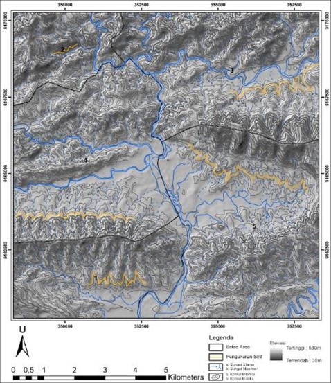
Mount Parang is a sill intrusion formed as partial melting due to tectonic activity namely subduction in Miocene which then broke through the Karangsambung formation and revealed to the surface as Mount Parang. Apart from the Mount Parang intrusion, the result of tectonic activity at that time is hills morphology with landforms in the form of anticline and syncline fold structures that stretch from east to west of the Karangsambung area. The geomorphological approach aims to determine the level of tectonic activity based on morphotectonic analysis around the Mount Parang intrusion. Morphotectonic analysis is conducted through a quantitative approach, by measuring and calculating geomorphic index variables using mathematical formulas. The index variables analysed include hypsometric integral (Hi), basin watershed asymmetry (AF), stream gradient-length index (SL), ratio of valley floor width to valley height (Vf), and mountain front sinuosity (Smf). Based on calculation Hi has a value of 1.0 with SL covering three classes. The AF index has a value of >50 with Vf values is between 0.26 and 0.87 and Smf values between 1.3 and 2.7. Based on these values, it indicates that the area around the Mount Parang intrusion has high tectonic activity.
References
Asikin, S., Handoyo, A. & Gafoer, S. 1992. Peta Geologi Lembar Kebumen, Jawa. Bandung, Pusat Penelitian dan Pengembangan Geologi.
Bull, W. B. & McFadden, L. D. 1980. Tectonic Geomorphology North and South of the Garlock Fault, California. In: Doehring, D. O. (ed.) Geomorphology in Arid Regions. Routledge. pp. 138-162. https://doi.org/10.4324/9780429299230
Cox, R. T. 1994. Analysis of drainage-basin symmetry as a rapid technique to identify areas of possible Quaternary tilt-block tectonics: An example from the Mississippi Embayment. Geological Society of America Bulletin, 106(5), pp. 571-581. https://doi.org/10.1130/0016-7606(1994)106<0571:Aodbsa>2.3.Co;2
Dar, R. A., Chandra, R. & Romshoo, S. A. 2013. Integrated Flood vulnerability Assessment for Flood Risk Management and Disaster Mitigation View project Multifrequecy polarimetric SAR View project. Journal of Mountain Science, 10, pp. 131-143. https://doi.org/https://doi.org/10.1007/s11629-013-2494
Doornkamp, J. C. 2022. Geomorphological approaches to the study of neotectonics. Journal of the Geological Society, 143(2), pp. 335-342. https://doi.org/10.1144/gsjgs.143.2.0335
El Hamdouni, R., Irigaray, C., Fernández, T., Chacón, J. & Keller, E. A. 2008. Assessment of relative active tectonics, southwest border of the Sierra Nevada (southern Spain). Geomorphology, 96(1-2), pp. 150-173. https://doi.org/10.1016/j.geomorph.2007.08.004
Hidayat, E., Muslim, D., Zakaria, Z., Permana, H. & Wibowo, D. A. 2021. Tectonic Geomorphology of the Karangsambung Area, Central Java, Indonesia. Rudarsko-geološko-naftni zbornik, 36(4), pp. 85-105. https://doi.org/10.17794/rgn.2021.4.8
Horton, R. E. 1932. Drainage‐basin characteristics. Eos, Transactions American Geophysical Union, 13(1), pp. 350-361. https://doi.org/10.1029/TR013i001p00350
Jordan, G. 2004. Terrain Modelling with GIS for Tectonic Geomorphology Numerical Methods and Applications, Disertasi, Acta Universitatis Upsaliensis.
Keller, E. A. & Pinter, N. 2002. Active tectonics : Earthquakes, uplift, and landscape (2 ed.). New Jersey, Prentice Hall.
Lone, A. 2017. Morphometric and Morphotectonic Analysis of Ferozpur Drainage Basin Left Bank Tributary of River Jhelum of Kashmir Valley, NW Himalayas, India. Journal of Geography & Natural Disasters, 7(3), pp. 1000208. https://doi.org/10.4172/2167-0587.1000208
Mahmood, S. A. & Gloaguen, R. 2012. Appraisal of active tectonics in Hindu Kush: Insights from DEM derived geomorphic indices and drainage analysis. Geoscience Frontiers, 3(4), pp. 407-428. https://doi.org/10.1016/j.gsf.2011.12.002
Nugroho, A. R. B., Sukiyah, E., Syafri, I. & Isnaniawardhani, V. 2020. Identification of Tectonic Deformation Using Morphometrical Analysis of Lamongan Volcano Complex. International Journal of GEOMATE, 19(71), pp. 55-60. https://doi.org/10.21660/2020.71.18490
Pemda Kebumen 2018. Laporan Usulan Geopark Karangsambung-Karangbolong. Kebumen.
Sarma, J. N., Acharjee, S. & Murgante, B. 2015. Morphotectonic study of the Brahmaputra basin using geoinformatics. Journal of the Geological Society of India, 86(3), pp. 324-330. https://doi.org/10.1007/s12594-015-0318-0
Schumm, S. A. 1956. Evolution of Drainage Systems and Slopes in Badlands at Perth Amboy, New Jersey. Geological Society of America Bulletin, 67(5), pp. 597-646. https://doi.org/10.1130/0016-7606(1956)67[597:Eodsas]2.0.Co;2
Sreedevi, P. D., Owais, S., Khan, H. H. & Ahmed, S. 2009. Morphometric analysis of a watershed of South India using SRTM data and GIS. Journal of the Geological Society of India, 73(4), pp. 543-552. https://doi.org/10.1007/s12594-009-0038-4
Strahler, A. N. 1952. Dynamic Basis of Geomorphology. Geological Society of America Bulletin, 63(9), pp. 923-938. https://doi.org/10.1130/0016-7606(1952)63[923:Dbog]2.0.Co;2
Strahler, A. N. 1964. Quantitative geomorphology of drainage basin and channel networks. In: Chow, V. T. (ed.) Handbook of applied hydrology. McGraw-Hill. pp. 39-76.
Downloads
Published
How to Cite
Issue
Section
License
Copyright (c) 2024 Poppy Ghufrani, Joko Soesilo

This work is licensed under a Creative Commons Attribution-ShareAlike 4.0 International License.