Observasi Dampak dan Kajian Pasca Gempa Bumi di Kabupaten Garut Menggunakan Analisis Mikrotremor
DOI:
https://doi.org/10.56099/ophi.v5i2.p78-86Keywords:
Gempa bumi Garut, skala Intensitas, mikrotremor, kerentanan, Sesar GarselaAbstract
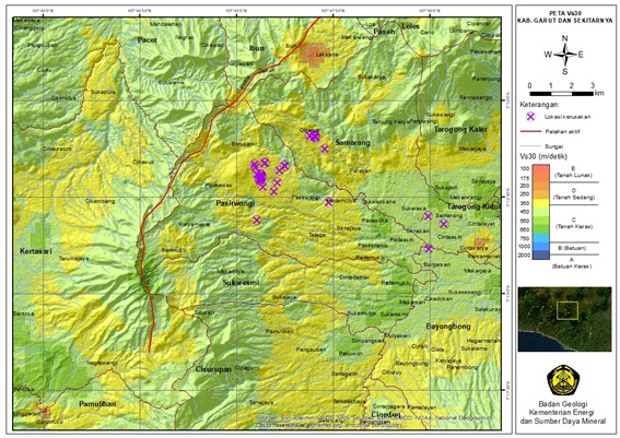
Hari rabu, 1 Februari 2023, pukul 22:57:21 WIB, guncangan gempa bumi terjadi di Kabupaten Garut dan sekitarnya berkekuatan M4,3 dengan kedalaman 3 km. Gempa ini diduga terkait dengan sistem sesar Garsela yang memiliki mekanisme sesar mendatar. Peristiwa ini menyebabkan bencana di dua Kecamatan, yaitu Samarang dan Pasirwangi. Intensitas maksimum gempa di Pasirwangi mencapai tingkat V MMI (Modified Mercalli Intensity). Salah satu metode yang digunakan adalah mengukur mikrotremor untuk memperkirakan respons lapisan tanah terhadap guncangan gempa, di mana variasi karakteristik gempa diwakili di permukaan tanah. Berdasarkan hasil pengukuran mikrotremor, potensi kerentanan terhadap guncangan gempa di Pasirwangi dan Samarang termasuk dalam kategori kerentanan menengah dengan nilai kerentanan antara e10-4 - e10-5.
References
Alzwar, M., Akbar, N. & Bachri, S. 1992. Peta Geologi Lembar Garut Pameungpeuk skala 1:100.000. Bandung, Pusat Penelitian dan Pengembangan Geologi.
BMKG. 2023. Parameter gempabumi Garut [Online]. Badan Metereologi dan Klimatologi. Available: https://www.bmkg.go.id/ [diakses pada 01-02- 2023].
Dardji, N., Villemin, T. & Rampnoux, J. P. 1994. Paleostresses and strike-slip movement: the Cimandiri Fault Zone, West Java, Indonesia. Journal of Southeast Asian Earth Sciences, 9(1-2), pp. 3-11. https://doi.org/10.1016/0743-9547(94)90061-2
DeMets, C., Gordon, R. G., Argus, D. F. & Stein, S. 1994. Effect of recent revisions to the geomagnetic reversal time scale on estimates of current plate motions. Geophysical Research Letters, 21(20), pp. 2191-2194. https://doi.org/10.1029/94gl02118
GFZ. 2023. Parameter gempabumi Garut [Online]. Geoforschungszentrums. Available: https://geofon.gfz-potsdam.de/ [diakses pada 01-02- 2023].
Hall, R. 2002. Cenozoic geological and plate tectonic evolution of SE Asia and the SW Pacific: computer-based reconstructions, model and animations. Journal of Asian Earth Sciences, 20(4), pp. 353-431. https://doi.org/10.1016/s1367-9120(01)00069-4
Hall, R. & Smyth, H. R. 2008. Cenozoic arc processes in Indonesia: Identification of the key influences on the stratigraphic record in active volcanic arcs. In: Draut, A. E., Clift, P. D. & Scholl, D. W. (eds.) Special Paper 436: Formation and Applications of the Sedimentary Record in Arc Collision Zones. Geological Society of America. pp. 27-54. https://doi.org/10.1130/2008.2436(03)
Hamilton, W. B. 1979. Tectonics of the Indonesian Region (Report No. 1078). Professional Paper, U.S. Govt. Print. Off. https://doi.org/10.3133/pp1078
Katili, J. A. & Soetadi, R. 1971. Neotectonics and seismic zones of the Indonesian Archipelago. In: Collins, B. W. & Fraser, R., eds. Proc. Int. Symposium Recent crustal movements and associated seismicity. Bull. Royal Soc. New Zealand. pp. 39-45.
Nakamura, Y. 1989. A method for dynamic characteristics estimation of subsurface using microtremor on the ground surface. Quarterly Report of Railway Technical Research, 30, pp. 25-33.
Nogoshi, M. & Igarashi, T. 1971. On the Amplitude Characteristics of Microtremor (Part 2). Zisin (Journal of the Seismological Society of Japan. 2nd ser.), 24(1), pp. 26-40. https://doi.org/10.4294/zisin1948.24.1_26
Pusgen 2017. Peta Sumber dan Bahaya Gempa Indonesia Tahun 2017. Jakarta, Badan Penelitian dan Pengembangan Kementerian Pekerjaan Umum dan Perumahan Rakyat.
Setyadji, I., Murata, I., Kahar, J., Suparka, S. & Tanaka, T. 1997. Analysis of GPS measurements in West-Java, Indonesia. Annuals of Disaster Prevention Research Institute, Kyoto University. 40 (B-1). pp. 27-33.
Sribudiyani, Muchsin, N., Ryacudu, R., Kunto, T., Astono, P., Prasetya, I., Sapiie, B., Asikin, S., Harsolumakso, A. H. & Yulianto, I. 2003. The collision of The East Java Microplate and Its Implication for hydrocarbon occurrences in The East Java Basin. Proceedings, Indonesian Petroleum Association 29th Annual Convention & Exhibition, Jakarta. Indonesian Petroleum Association (IPA). pp. IPA03-G-085.
Supartoyo, Putranto, E. T. & Djadja 2005. Active Faults and Destructive Earthquake Epicenter Distribution Map of Indonesia. Bandung, Direktorat Vulkanologi dan Mitigasi Bencana Geologi, Badan Geologi, Kementerian Energi dan Sumber Daya Mineral.
Supartoyo, Robiana, R., Natalia, M. C. & Hespiantoro, S. 2020. Dampak Gempa Bumi Lombok Tahun 2018. Jurnal Geominerba (Jurnal Geologi, Mineral Dan Batubara), 5(1), pp. 61-76. https://doi.org/10.58522/ppsdm22.v5i1.65
Supartoyo, Surono & Putranto, E. T. 2014. Katalog gempa bumi merusak di Indonesia Tahun 1612 – 2014. Bandung, Pusat Vulkanologi dan Mitigasi Bencana Geologi.
Tjia, H. D. 1968. The Lembang Fault, West Java. Geologie En Mijnbouw, 47(2), pp. 126-130.
USGS. 2023. Parameter gempabumi Garut [Online]. Available: https://earthquake.usgs.gov/earthquakes/ [diakses pada 01-02- 2023].
van Bemmelen, R. W. 1970. The Geology of Indonesia (2 ed.). The Hague, Martinus Nijhoff.
Downloads
Published
How to Cite
Issue
Section
License
Copyright (c) 2023 Merry Christina Natalia, Rahayu Robiana

This work is licensed under a Creative Commons Attribution-ShareAlike 4.0 International License.